Please Note: The content on this page is not maintained after the colloquium event is completed. As such, some links may no longer be functional.
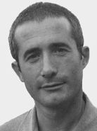
Andrea Baraldi
Research Associate Professor
University of Maryland
Satellite Image Automatic MapperTM (SIAMTM)
Wednesday, February 23, 2011
Building 3 Auditorium - 3:30 PM
(Coffee and cookies at 3:00 PM)
***Note afternoon starting time***
While the demand for spaceborne Earth observation (EO) data has continued to increase in terms of both data quantity and quality, the automatic or semi-automatic transformation of huge amounts of multi-source multi-resolution remote sensing (RS) imagery into information still remains far more problematic than might be reasonably expected. For example, supervised data learning algorithms (say, Support Vector Machines, SVMs), considered successful at local/regional scale, turn out to be impracticable/unable to classify remote sensing (RS) image mosaics at national/continental/global scale. This means that, in RS common practice, the cost, timeliness, quality and availability of adequate reference (ground truth) data sets are becoming the most limiting factors on RS data product generation and validation. To increase the operational quality indicators of RS image understanding systems (RS-IUSs), namely, degree of automation, efficiency, effectiveness, robustness to changes in the input data set, robustness to changes in input parameters, scalability, timeliness and economy, two actions are undertaken. (1) A novel two-stage stratified hierarchical hybrid RS-IUS architecture is proposed. (2) An operational, near real-time, multi-sensor, multi-resolution prior knowledge-based decision-tree classifier, called Satellite Image Automatic MapperTM(SIAMTM), is implemented as the preliminary classification first stage of a two-stage stratified hierarchical hybrid RS-IUS.
In this seminar, SIAMTM is proposed to the multi-disciplinary NASA community of experts by means of a few technical details together with several spaceborne EO data application examples, namely: automatic Land Cover (LC) classification from regional to continental scale, automatic LC change (LCC) detection from regional to continental scale, flaming and smoldering fire detection, burned area detection, cloud detection, semantic querying of large-scale RS image databases.
Eng. Baraldi is a research associate professor at the Department of Geography of the University of Maryland since Sept. 2010. He held research fellowships at the Italian national Research Council (1989, 1994-1996, 2003-2004), European Space Agency (1991-1993), International Computer Science Institute, Berkeley, CA (1997-1999), Institute for Environment and Sustainability of the European Commission's Joint Research Center (EC-JRC) (2000-2002, 2005-2009). Eng. Baraldi served as Associate Editor of the IEEE Transactions on Neural Networks from 2001 to 2006.
IS&T Colloquium Committee Host: Jim Tilton
Sign language interpreter upon request: 301-286-7040
Request future announcements
